
Wye Solutions Map
The Map of Project Areas and Funding in the Wye Catchment has been developed in collaboration with the Wye Catchment Partnership to provide a comprehensive overview of ongoing nature recovery, pollution reduction, flood mitigation and climate resilience efforts in the catchment. The map collates projects that are aligned with the Wye Catchment Partnership’s stated objective to restore the catchment to a state that supports favourable conservation status of the designated features of the Wye Special Area of Conservation (SAC) and the Lugg SSSI.
Explore the local projects above, or access the full map including large scale projects and research and data projects here: Project Areas and Funding in the Wye Catchment.
This map will be updated periodically to reflect the status of projects in the catchment. It requires no logins or paywalls for interaction and has been designed to promote open sharing of information and cross-project collaboration.
The map shows the geographic reach of each project as well as qualitative project information including (but not limited to): project lead, funding total, start and end date, project contact information and further links where possible. It captures both capital invested projects that represent action on the ground, alongside advisory projects and data and research projects, with their geographic remit.
To contribute or update project information, please fill in this form: Wye Catchment Interventions - Project (google.com). Submitted data will undergo a light vetting process before inclusion on the map. Once validated, the embedded map on the WCP website will showcase the project information. For general feedback and queries, please contact science@fouw.org.uk or admin@wyecatchmentpartnership.info.
Project summary - in numbers
April 2024
£3.75 million invested specifically in the Wye (up from £2.75m in Jan), across 19 projects currently under delivery (up from 15 in Jan)
with £2.1M shared with other catchment areas (Usk, Severn), totalling £5.85M.
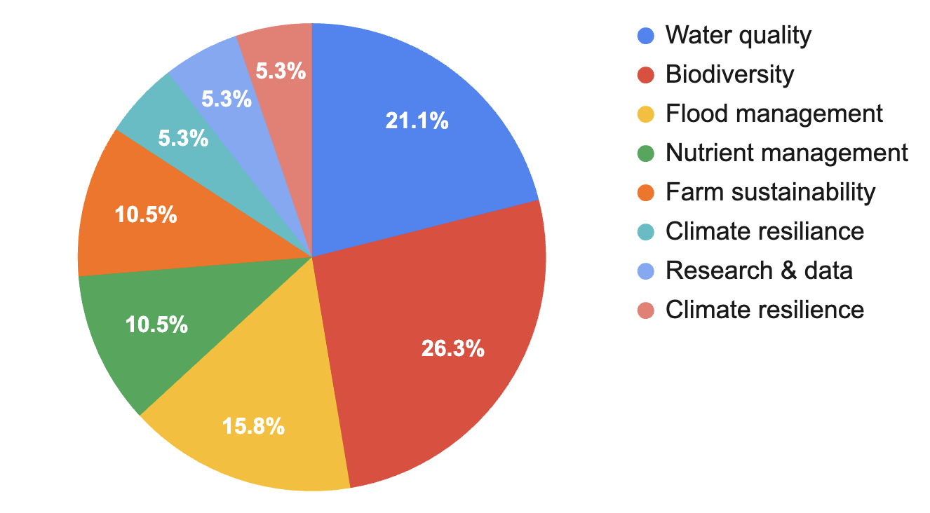
Project primary objectives:
Project deliverables:

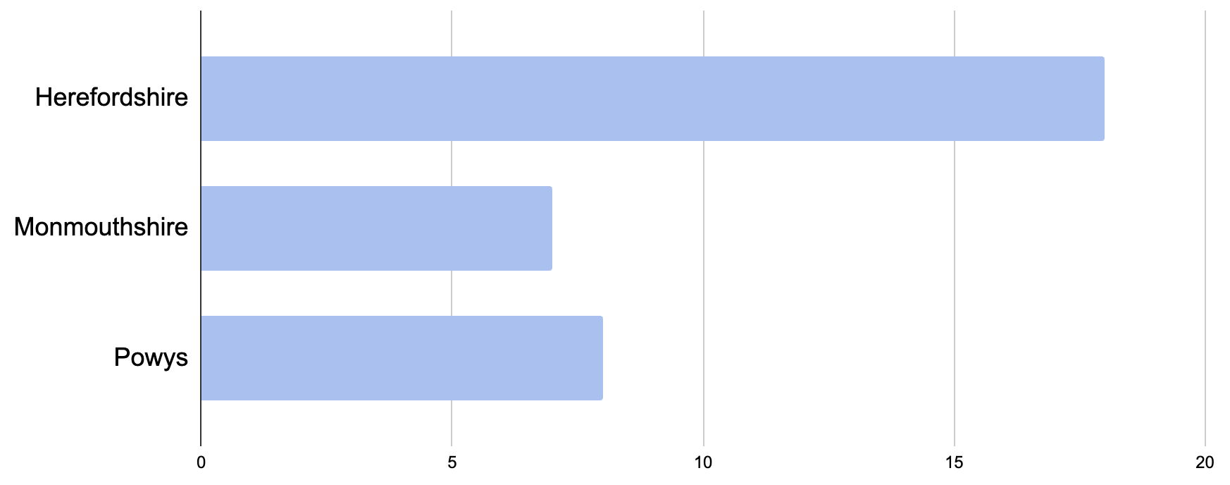
Project areas:
5 case study farms, 20% high risk nature based solutions implemented, 50 landowners join Government Land Management Scheme, 15,000 ha sustainable one to one advice given.
Implementation of natural flood management solutions across five land holdings.
Engage 375 farmers per year.
540 ha pipelined into schemes. 5000 people engaged. 40 landowners given specific advice.
60 hectares of meadow/habitat creation.
Phosphorous reduction in sewage treatment works outfall.
Survey fish populations each year.
Natural capital assessments of 26 smallholdings, number of interventions.
Deliver invasive species control along the Wye and tributaries – 116km d/b.
To use natural flood management measures to reduce the flood risk to Herefordshire communities associated with the seven priority sub-catchments.